Drone Measurement Software: How to Increase the Efficiency of Your Construction Projects
What is Drone Measurement Software?
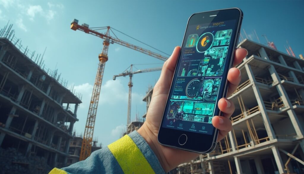
Bei Drone Measurement Software we are talking about specialized applications that process data from unmanned aerial systems (UAS), namely drones. Why all this? To create precise measurements and models of terrains, buildings, and infrastructures. This technology of drone measurement software utilizes advanced photogrammetry algorithms and sometimes LiDAR (Light Detection and Ranging). From a multitude of aerial images, it generates detailed 3D models, point clouds, orthomosaics, and digital elevation models (DEMs). At its core, it involves the drone capturing images or scanning data, and the drone measurement software processes this raw data to extract accurate geometric information. One could say that this type of software is a crucial tool for modern surveying and the construction data management, as it enables rapid and accurate capture of complex environments. At Valoon GmbH, our goal is to simplify exactly such processes. We transform everyday messenger communication into structured project data – a method that also perfectly complements a drone measurement software documentation.
- Definition and Technology: Specialized software that processes drone data (images, LiDAR) using photogrammetry to create accurate 3D models, point clouds, and orthomosaics.
- Importance and Benefits: Revolutionizes traditional surveying through significant time and cost savings, increased safety, and centimeter-accurate data for precise planning.
- Objective of the Article: Comprehensive overview of the functioning, advantages, areas of application, selection criteria, common solutions, and legal aspects of the Drone Measurement Software.
Why is Drone Measurement Software important?
It cannot be stressed enough: The importance of drone measurement software in the modern construction industry and related sectors is immense. It revolutionizes traditional surveying methods by enabling significant time and cost savings . Projects that used to require days or weeks of manual work can often now be completed within a few hours. Furthermore, the technology enhances safety since inaccessible or hazardous areas can be surveyed without anyone having to be on-site. The accuracy of captured data, especially when using RTK-capable drones, often reaches centimeter-level – essential for precise planning and executions with drone measurement software. The ability to create detailed 3D models not only improves visualization and collaboration among all project participants but also helps to identify errors early on. For us at Valoon, where we are fully committed to optimizing communication and project management, integrating such data is another logical step towards increasing efficiency, for example, through an automated construction documentation..
Objective of this Article
In this article, we want to provide you with a comprehensive overview of the functioning, benefits, and areas of application of drone measurement software . We will explain the basic technologies, discuss criteria for selecting the right drone measurement software software, and present you with common solutions available in the market. In addition, we will address legal aspects and the economic viability of this technology. Our aim is to equip you with the knowledge to make informed decisions on how drone measurement software you can optimize your project workflows and contribute to increased efficiency in your company. Let’s explore together how you can elevate your construction projects with this innovative technology. For even easier data collection on-site, even in the context of drone data, our measurement app could be a valuable addition. Just reach out to us! We will be happy to give you personalized advice on how to best utilize these technologies.Basics of Drone Measurement: From Traditional to Digital
What is a measurement?
A measurement refers to the detailed capture and documentation of the geometric dimensions of an existing object, terrain, or structure. It serves as the basis for planning, cost estimations, invoicing, and quality control. In the past, measurements were painstakingly done by hand with measuring tapes, yardsticks, and theodolites – a process often time-consuming and prone to errors. The result of a measurement is exact measures like lengths, areas, and volumes, which are needed for further processing, for example, in CAD programs or using drone measurement software, are used. With drone measurement software , this entire process is now digitized and automated, achieving greater accuracy and efficiency. Accurate capture is particularly important for the construction software, which builds on this data to enable precise planning and calculations.
- Time Savings: Drones can capture large areas and complex structures in a fraction of the time required for manual measurements. The automated data processing by the drone measurement software adds to the speed of the process.
- Cost Efficiency: Due to the reduced time and personnel effort that drone measurement software enables, the overall costs for measurements decrease. The costs can, depending on the project, be significantly lower than those of traditional methods.
- Increased Safety: Hazardous or hard-to-reach areas, such as roofs, facades, or unstable terrain, can be safely surveyed from a distance, a core advantage of the drone measurement software, which minimizes the risk of accidents for personnel. This is an important aspect that is often emphasized in the use of drones on construction sites .
- Higher Accuracy Compared to Satellite Data: While satellite data can be useful for rough overviews, drone measurements, especially with RTK technology and processed through drone measurement software, provide significantly more precise data with centimeter-level accuracy. This is essential for detailed planning.
Traditional Measurement Methods vs. Drone Measurement
When comparing traditional measurement methods with drone measurement, significant differences in efficiency, safety, and data quality quickly become apparent. Consider traditional methods, such as manual measuring with a tape measure or the use of total stations: these are often personnel-intensive, time-consuming, and can hit their limits with complex or hard-to-reach structures. Additionally, there is an increased safety risk when working at heights or in hazardous environments. The traditionelle Methoden, wie das manuelle Messen mit Maßband oder der Einsatz von Tachymetern: Diese sind oft personalintensiv, zeitaufwendig und können bei komplexen oder schwer zugänglichen Strukturen an ihre Grenzen stoßen. Zudem besteht bei Arbeiten in der Höhe oder in gefährlichen Umgebungen ein erhöhtes Sicherheitsrisiko. Das drone measurement shows its strengths here: It allows for rapid data capture from the air, enabling large areas and complex geometries to be captured in a short time, often supported by drone measurement software. The data generated, such as point clouds and 3D models, offer a much higher information density than traditional measurement points. The use of drone measurement software significantly reduces manual effort and minimizes the risk of human error. A guide to the digital construction site can show you how such technologies can be integrated into the overall process.
Advantages of Drone Measurement
The use of drone measurement software brings a whole range of benefits that make traditional methods look outdated. And it is precisely these benefits that are crucial for optimizing construction projects and other surveying tasks. The combination of rapid data capture and precise evaluation through drone measurement software makes this technology an incredibly valuable tool.Functionality of Drone Measurement Software: From Data Capture to Analysis
Data Capture with Drones
Everything begins with data capture – and this is one of the most important steps in the drone measurement process. Here, careful flight planning and execution are paramount for the quality of the final results achieved with drone measurement software . Many modern drone measurement software-solutions often come with built-in tools for flight planning, such as the , which enables systematic and automated flight paths. It is important to consider the significance of sufficient image overlap (typically at least 60-80%) and the challenge when dealing with homogeneous surfaces (e.g., water, snow, large monochrome roofs). For the highest precision, often in the range of +/- 3cm, RTK drones (Real-Time Kinematic) are used, which can determine their position with centimeter-level accuracy. The camera and shutter technology is also significant; a mechanical shutter is often advantageous to minimize motion blur and provide sharper images for photogrammetry using drone measurement software . The data collected in this way can then be seamlessly integrated into systems for mobile data collection for construction .
- Data Capture: Includes careful flight planning, sufficient image overlap, the use of RTK drones for precision, and attention to camera technology.
- Photogrammetry and 3D Modeling:Drone measurement software creates dense point clouds, orthomosaics, terrain models, and 3D meshes from overlapping photos, including georeferencing for BIM/CAD integration.
- Data Processing and Analysis: Enables volume calculations, progress tracking, inspection reports, and can be enhanced with integrations like messenger services and automatic translations.
Photogrammetry and 3D Modeling
Once the data is in the box, the actual drone measurement software comes into play to create 3D models using photogrammetry. Photogrammetry – this is the technique where precise 3D information is derived from overlapping photos. The drone measurement software analyzes the images, identifies common points, and calculates a dense point cloud, which represents the three-dimensional structure of the captured object or terrain. From this point cloud, various products can be generated, including orthomosaics (rectified, scale-accurate aerial images), digital terrain models (DTMs), digital surface models (DSMs), and textured 3D meshes. A very important step here is the georeferencing of the data, often using ground control points (GCPs) or the precise position data from RTK drones to correctly locate the models in space and enable seamless integration with BIM systems (Building Information Modeling) and CAD software. Some advanced drone measurement software solutions also offer an automatic point cloud classification through machine learning, to distinguish, for example, vegetation from buildings.
Data Processing and Analysis
The data processed by our drone measurement software opens up a wealth of analysis possibilities. What can such drone measurement software packages do? Core functions often include volume calculation (e.g., for earthworks or material piles), progress tracking on construction sites through regular flights and comparing 3D models over time, as well as creating detailed inspection reports for structures or roofs. Here at Valoon GmbH, we even take it a step further by enabling the integration of messenger services like WhatsApp for easy data collection directly on-site. Just imagine: Your field staff send photos and notes via WhatsApp, which are then automatically structured and incorporated into the project data of the drone measurement software or other project management tools. And one more thing that makes our solution unique: the automatic translation into over 50 languages. This significantly simplifies collaboration in international teams and makes the use of captured drone data globally accessible. Such approaches are part of our mission to make AI in construction usable for you, often in conjunction with drone measurement software.Software Selection Optimization: How to Find the Right Drone Measurement Solution
Criteria for Software Selection
Choosing the right drone measurement software is truly crucial for the success of your projects. You best start by precisely defining your specific project requirements and the scope : Is it about simple roof measurements, complex terrain modeling, or detailed facade inspections? User-friendliness and how quickly one can familiarize themselves are important factors, especially if your personnel have no prior knowledge of photogrammetry or specificapplications. Look for intuitive interfaces and good training offers here – it pays off. Then, there are the drone measurement software hat. Achten Sie hier auf intuitive Oberflächen und gute Schulungsangebote – das zahlt sich aus. Dann sind da noch die accuracy requirements – another critical point; for many construction applications, compliance with the VOB (Construction Contract Procedures) is relevant. Look closely: Can the (Vergabe- und Vertragsordnung für Bauleistungen) relevant. Schauen Sie genau hin: Kann die drone measurement software deliver the precision you need, for example through support for RTK data and GCPs? And very importantly for a smooth workflow: the compatibility with your existing software (CAD/BIM). So make sure that your new drone measurement software supports common export formats like .las, .dxf, .ifc, or .shp. Finally, of course, the costs also play a role, consisting of software licenses (subscription or purchase), any necessary hardware (high-performance PCs), and training efforts. If you carefully weigh these criteria, you are well on your way to finding the optimal solution for yourself.
- Important Selection Criteria for drone measurement software: Consider project requirements, user-friendliness, accuracy needs (if applicable VOB compliance), compatibility with CAD/BIM systems, and total costs.
- Common drone measurement software Solutions: Compare options like PIX4Dmapper, DJI Terra, Agisoft Metashape, and specialized platforms like Airteam Fusion, each with specific strengths.
- Cloud vs. Desktop: Weigh the difference between desktop solutions (full data control, hardware-intensive) and cloud solutions (computing power outsourced, collaborative, internet dependency).
Comparison of Common Software Solutions
The market for drone measurement software is diverse and offers a whole range of solutions, each with different strengths. For example, we have , considered one of the leading photogrammetry software for professional drone mapping, also offers PIX4Dmatic and PIX4Dcloud for drone measurement software solutions for large datasets and cloud processing. It is characterized by high accuracy and extensive editing options. is specifically optimized for processing data from DJI drones and also supports LiDAR data, making it interesting for applications in land surveying and the energy sector. is another flexible and powerful tool for 3D modeling, often praised for its detailed configuration options and the quality of the results. The Airteam Fusion Platform has specialized in roof and building measurements and uses AI for quick and precise measurements, particularly relevant for roofers and solar installers. Each of these drone measurement software-solutions naturally has its specific advantages and disadvantages, which need to be weighed in the context of one’s own requirements. Many providers, such as Coptrz, offer comparisons of the
Cloud-based vs. Desktop-based Solutions
When it comes to choosing a drone measurement software , companies often face the question: cloud-based or desktop-based? Desktop software like PIX4Dmapper or Agisoft Metashape is installed locally on a powerful computer and run there. This gives you, as a user, full control over your data and the processing process but often requires significant computing power and corresponding hardware investments. The advantage lies in the potentially unlimited amount of data (depending on hardware) and the possibility of working without a constant internet connection. Cloud-based solutions, like PIX4Dcloud or parts of the Airteam Fusion Platform, on the other hand, outsource the computing-intensive processing to the provider’s servers. The beauty of this: it reduces the demands on your local hardware and often allows faster processing of large datasets through parallel processes. Additionally, cloud solutions facilitate teamwork and sharing project results with clients and team members through simple web links. Possible downsides here are ongoing subscription costs for the drone measurement software dort aus. Das gibt Ihnen als Anwender die volle Kontrolle über Ihre Daten und den Verarbeitungsprozess, erfordert aber oft erhebliche Rechenleistung und entsprechende Hardware-Investitionen. Der Vorteil liegt in der potenziell unbegrenzten Datenmenge (abhängig von der Hardware) und der Möglichkeit, auch ohne ständige Internetverbindung zu arbeiten. Cloud-basierte Lösungen, wie PIX4Dcloud oder Teile der Airteam Fusion Platform, hingegen lagern die rechenintensive Verarbeitung auf die Server des Anbieters aus. Das Schöne daran: Es reduziert die Anforderungen an Ihre lokale Hardware und ermöglicht oft eine schnellere Verarbeitung großer Datenmengen durch parallele Prozesse. Zudem erleichtern Cloud-Lösungen die Zusammenarbeit und das Teilen von Projektergebnissen mit Kunden und Teammitgliedern über einfache Weblinks. Mögliche Nachteile sind hier laufende Abonnementkosten für die drone measurement software and dependency on a stable internet connection, as well as concerns regarding data security and sovereignty. Which option is better depends heavily on your individual needs, budget, and IT infrastructure of your company. Often, a combination offering both desktop and cloud options can provide the greatest flexibility. drone measurement software sowohl Desktop- als auch Cloud-Optionen bietet, die größte Flexibilität gewährleisten.Areas of Application: Here, Drone Measurement Software Creates Real Value
Construction Industry
In the construction industry, the drone measurement software is transforming several processes – and in a positive way! For example, take the construction progress monitoring. Through regular flights, detailed 3D models of the current construction state can be created and compared with the planning data (BIM models). This allows you to detect deviations early and document progress transparently, a clear advantage of the drone measurement software. Equally essential are precise terrain captures and volume calculations for planning earthworks, material quantity calculations, and invoicing. And for this purpose, the drone measurement software provides the necessary accurate data quickly and cost-effectively. Also, during the inspection of structures, such as bridges, facades, or industrial facilities, drones make the work safer and more efficient. Hard-to-reach areas can be captured in detail, and damages can be detected early without having to use expensive scaffolding or lifts. The integration of this data into a construction data management software optimizes the entire construction process. The use of Digital Construction methods is significantly supported.
- Agriculture: Analyzing plant growth, creating fertilization maps using drone measurement software.
- Environmental Monitoring: Documenting environmental changes, monitoring nature reserves.
- Disaster Relief: Rapid assessment of damage situations for coordinating rescue efforts.
- Real Estate Valuation & Facility Management: Condition analyses, 3D visualizations.
Roofers and Carpenters
For roofers and carpenters, drone measurement software offers enormous advantages. Just think about precise roof measurements for planning and quoting – these can be created in no time. No more dangerous and time-consuming manual measuring on the roof; instead, the drone provides all relevant dimensions, slopes, and details. This leads to more accurate calculations and reduces planning errors. With the drone measurement software , you can then create 3D models, which can be used not only for the measurement itself but also for planning dormers, extensions, or the integration of PV systems. And in the damage assessment, for example, after storms, drones enable a quick and safe assessment of the extent of the damage, speeding up the settlement with insurance companies. The combination of drone technology and specialized drone measurement software solutions like the Airteam Fusion Platform, specifically designed for construction, is particularly effective. Such digital tools are a core component of the digital construction site
in trades.
Solar System Planning drone measurement software In solar system planning, shows its strengths. A precise capture of roof surfaces drone measurement software is key for optimal module placement and thus for maximum energy yield. With drones, you can quickly and accurately capture the geometry of the roof, including structures like chimneys or dormers. The drone measurement software solutions offer special modules for PV planning that create layouts directly from the 3D models and optimize the number of required modules as well as cable routing. The precise data also supports the selection of the appropriate mounting system and the creation of detailed installation plans.
Other Areas of Application
But not only in the construction industry, roofing trades, and solar system planning are there numerous other sectors that can benefit from drone measurement software the technology. In agriculture, for example, it is used for precision agriculture, such as analyzing plant growth, creating fertilization maps, or identifying problem areas in fields. In zum Beispiel wird drone measurement software für die Präzisionslandwirtschaft eingesetzt, etwa zur Analyse des Pflanzenwachstums, zur Erstellung von Düngekarten oder zur Identifizierung von Problemzonen auf Feldern. Im environmental monitoring, it serves drone measurement software to document environmental changes, monitor nature reserves, or assess erosion damage. In disaster relief, the rapid aerial assessment of damages allows for efficient coordination of rescue efforts, for example, after floods or earthquakes. Drones and the associated Katastrophenschutz ermöglicht die schnelle Erfassung von Schadenslagen aus der Luft eine effiziente Koordination von Rettungsmaßnahmen, beispielsweise nach Überschwemmungen oder Erdbeben. Auch in der Immobilienbewertung und im Facility Management kommen Drohnen und die zugehörige drone measurement software are increasingly being utilized in real estate appraisal and facility management to create detailed condition analyses of buildings and properties or generate appealing 3D visualizations for marketing. Clearly, the versatility of this technology is constantly opening up new possibilities and fields of application.Overcoming Legal Hurdles: Drone Regulation and Data Protection in Focus
Drone Regulation and Flight Restrictions
Those wishing to use drones for measurement must deal with some legal framework conditions that must be taken into account. First, there is the current drone measurement software nutzt, muss sich mit einigen rechtlichen Rahmenbedingungen auseinandersetzen, die unbedingt beachtet werden müssen. Da ist zunächst die aktuelle EU Drone Regulation, which is applicable in all member states and classifies drone flights based on risk while establishing corresponding requirements. For many professional applications in the field drone measurement software you need a requirement for approval or an operator registration and often also a drone license (EU competence certificate A1/A3 or EU remote pilot certificate A2). In addition, there are numerous no-fly zones, for example, near airports, industrial plants, crowds, or over nature reserves. Safety distances to uninvolved persons and objects must also be maintained. To keep track of these aspects and ensure legal flights, we recommend using Sicherheitsabstände zu unbeteiligten Personen und Objekten einzuhalten. Damit Sie hier den Überblick behalten und legale Flüge sicherstellen, empfehlen wir die Nutzung von flight planning and monitoring apps such as , which show current flight restrictions. A thorough engagement with local and regional regulations for drone operations and the use of drone measurement software is therefore essential to avoid fines and legal consequences.
Data protection and GDPR compliance
But not only the flight law aspects are important – data protection plays a vital role in the deployment of , especially when personal data could be collected. This is always the case when your drone footage might depict private properties, buildings, or even recognizable individuals. The drone measurement software, insbesondere wenn personenbezogene Daten erfasst werden könnten. Das ist immer dann der Fall, wenn Ihre Drohnenaufnahmen beispielsweise private Grundstücke, Gebäude oder gar erkennbare Personen abbilden könnten. Die General Data Protection Regulation (GDPR) of the EU lays down clear rules for the handling of personal data . If you conduct drone measurements and process the data with drone measurement software , you must ensure that you comply with the principles of data minimization, purpose limitation, and transparency. Often you need consent declarations from the affected property owners or individuals before recordings can be made. Therefore, always inform transparently about which data is collected for what purpose and how long it will be stored. Anonymization or pseudonymization measures can help minimize data protection risks when using drone measurement software . At Valoon GmbH, we place great importance on data security and privacy. This also applies to our handling of data from mobile data collection in construction and is equally crucial for the use of drone measurement software .Cost-benefit check: When does drone measurement software pay off for you?
Cost factors in drone measurement
Of course, the implementation of drone measurement software and the associated hardware initially involves various costs. First, there’s the purchase and maintenance of drones. Professional surveying drones, especially RTK-capable models with high-quality cameras, can cost several thousand to ten thousand euros. In addition, there are costs for batteries, spare parts, and regular maintenance. Then there are the software licenses and updates as an additional cost factor. Many providers of drone measurement software rely on subscription models here (monthly or yearly), while others offer one-time purchase licenses with optional maintenance contracts for updates. Prices vary widely depending on the range of features and provider, from several hundred to several thousand euros per year. And let’s not forget: the costs for training and education of staff to safely operate the drones and to drone measurement software use them efficiently. Finally, there is the appropriate flight insurance (liability insurance for drones), which is legally required and also incurs ongoing costs. A detailed listing of helps with budget planning.
Amortization and ROI
But don’t worry: Despite these initial and ongoing costs, investment in drone measurement software and drone technology can quickly pay off and achieve a positive return on investment (ROI). The significant time savings and efficiency gains in data collection and analysis through drone measurement software lead to direct cost reductions. You can complete projects faster and thus enhance your competitiveness. With more precise data from the drone measurement software you reduce planning errors and thereby avoid costly rework and material waste. Often, you can realize lower personnel costs as fewer employees are needed for measurements or they can be deployed for other value-added activities. A good example is the productivity increase experienced by Sunergic SA through the use of Pix4D software for roof measurements (reducing hours to minutes) – this can significantly impact ROI. Improved safety and the ability to offer new services (e.g., detailed 3D visualizations) also contribute to profitability. If you carefully analyze your processes and potential savings, you can accurately calculate the ROI for implementing drone measurement software .
Financing and funding opportunities
If you are currently considering investing in drone measurement software and the associated technology, there’s good news: There are various financing and funding options that can lower the financial hurdle. Many banks and financial services providers offer specialized loan programs or leasing models for commercial investments in digitalization technologies. These can help distribute the acquisition costs over several installments and preserve your company’s liquidity. Moreover, there are various funding programsat the federal and state levels in Germany that support digitalization in small and medium-sized enterprises (SMEs). Programs like “Digital Now” or specific funding from the Reconstruction Loan Corporation (KfW) can provide grants or low-interest loans for investments in hardware and drone measurement software as well as for training employees in the field of drone measurement software . It’s worth researching current offers and checking whether your investment project is eligible for funding. Sometimes drone manufacturers or drone measurement software also offer their own financing options or package deals that make entry easier.Looking into the future: What to expect from drone measurement technology
Further development of drone technology
The development of drone technology is not standing still – quite the opposite! It is advancing rapidly and promises exciting innovations for the field of drone measurement software. A very important trend is the increasing prevalence of autonomous drone flights and inspections. One can imagine that future systems will be capable of autonomously planning and executing complex inspection routes, avoiding obstacles, and capturing and pre-processing data without human intervention. Simultaneously, the development of improved sensors and camera resolution is steadily progressing. Higher-resolution cameras, more powerful LiDAR sensors, and the integration of multispectral or thermal sensors will provide even more detailed and meaningful data. And another crucial factor: the ongoing integration of artificial intelligence (AI) directly into the drone (Edge AI) or into the drone measurement software. AI algorithms can, for instance, automatically recognize and classify objects, identify anomalies, or optimize flight planning. All these developments will further enhance the efficiency, accuracy, and application possibilities of drone measurements and their associated drone measurement software and solidify the role of AI in construction. New application areas and business models
With each technological advancement, new application areas and business models continuously emerge
for . It can be assumed that drones will increasingly be used in areas like indoor navigation and measurement, once the technology and the supporting mature enough for this. The combination of drone data with augmented reality (AR) and virtual reality (VR) offers potential for immersive construction site visits and planning reviews. In the field of facility management, drones could regularly conduct autonomous inspection flights and report deviations from the target condition. This, in turn, could lead to entirely new service offerings, such as “Surveying-as-a-Service” or specialized inspection services for specific industries. This capability to quickly and cost-effectively create highly precise digital twins of the real world using drone measurement software. Man kann davon ausgehen, dass Drohnen über die etablierten Felder hinaus verstärkt im Bereich der Indoor-Navigation und -vermessung eingesetzt werden, sobald die Technologie und die unterstützende drone measurement software hierfür ausgereift ist. Die Kombination von Drohnendaten mit Augmented Reality (AR) und Virtual Reality (VR) bietet Potenzial für immersive Baustellenbegehungen und Planungsreviews. Im Bereich des Facility Managements könnten Drohnen regelmäßig autonome Inspektionsflüge durchführen und Abweichungen vom Soll-Zustand melden. Das wiederum könnte zu ganz neuen Dienstleistungsangeboten führen, wie “Surveying-as-a-Service” oder spezialisierte Inspektionsdienste für bestimmte Branchen. Diese Fähigkeit, schnell und kostengünstig hochpräzise digitale Zwillinge von der realen Welt mittels drone measurement software will form the basis for many exciting, data-driven business models of the future. At Valoon GmbH, we of course closely monitor these trends to continuously improve our solutions for automated construction documentation. and project management for you.
Importance of standards and certifications
The more the use of drone measurement software spreads and professionalizes, the more important standards and certifications will become. We need uniform standards for data formats, process workflows, and quality requirements to ensure interoperability between different systems in the. Wir brauchen einheitliche Standards für Datenformate, Prozessabläufe und Qualitätsanforderungen, um die Interoperabilität zwischen verschiedenen Systemen der drone measurement software and ensure comparability of results. Certifications for drone pilots, such as the aforementioned EU drone license, help to increase flight safety. One can imagine that future certifications for the quality of drone measurements or for competence in handling specific drone measurement software will gain importance. Because such standards and certifications build trust among clients and users and contribute to establishing drone measurement software as a reliable tool in professional applications. Organizations like the are working on developing tools that can support such standardizations. For the construction software-industry, adherence to industry standards such as IFC for BIM is essential.Get started: Drone measurement software as your key to more efficient projects
Summary of benefits and challenges
Let’s summarize: Drone Measurement Software has established itself as a truly transformative technology for numerous industries, particularly the construction sector. The benefits are obvious: significant time and cost savings, increased safety in data collection, superior accuracy compared to traditional methods or satellite data, and the creation of detailed 3D models for improved planning and visualization. The ability to quickly generate precise data optimizes your workflows from the measurement app to the complex construction data management software. On the other hand, there are of course also challenges, such as initial investment costs for drones and drone measurement software, the training effort for staff, compliance with complex legal frameworks and data protection regulations, as well as the technical aspects of data processing and interpretation. Choosing the right drone measurement software, such as for large data sets or specialized solutions for roof measurements, is really crucial for your success.
Outlook on future developments
And what does the future of drone measurement software look like? We would say very promising! We can expect ongoing automation of the entire process chain of drone measurement software , from autonomous flight planning and data collection to AI-powered analysis and reporting. The sensors will become even more powerful, the integration with other digital tools like BIM and GIS will deepen, and application areas will continue to diversify. We expect that cloud-based solutions will gain significance, as they facilitate scalability and collaborative work. The development of more user-friendly interfaces and the reduction of barriers to entry will further promote acceptance. For us at Valoon GmbH, who specialize in optimizing communication and project management through digital tools, integrating advanced drone measurement software and the data obtained from it holds enormous potential to further improve the flow of information between field operations and the office and make the digital construction site a reality.
Recommendations for companies and users
If you as a company are now considering using drone measurement software , we recommend starting with a thorough needs analysis and defining clear goals. Perhaps start with pilot projects to gain initial experiences and evaluate the technology before making larger investments. Very importantly: invest in training your employees to ensure they can operate the drones safely and use the drone measurement software efficiently. And please ensure compliance with all legal regulations and data protection standards. Choose a software solution that truly fits your specific requirements and allows for good integration into your existing systems. We at Valoon GmbH are happy to support you in optimally integrating the data gathered through drone measurement software into your project management and communication processes. Our platform simplifies data collection and processing, sustainably improving the flow of information. Utilize the potentials of digitalization to make your projects more efficient, cost-effective, and safer. Discover for yourself how our solutions, including the integration of messaging services for data collection, can help you fully leverage the benefits of drone measurement software and optimize your projects with drone measurement software . Please contact us today for personalized consultation and find out how you can revolutionize your construction projects. Get started now and request more information through our contact form an.
What concrete benefits does drone measurement software offer my construction company?
Drone Measurement Software allows you a significant time savings in surveying, often by many hours per project. You achieve a higher accuracy than with traditional methods or satellite data, reducing planning errors. Additionally, it increases safety, as dangerous areas can be surveyed without direct personnel involvement, and leads to cost savings due to lower personnel and time expenditure.
How precise are the results of drone measurement software?
The accuracy is very high. With RTK-capable drones and professional Drone Measurement Software you can achieve accuracies in the centimeter range (e.g., +/- 3 cm) . This is absolutely sufficient for detailed construction planning, volume calculations, and quality control, and often more precise than manual measurements.
Is the onboarding for drone measurement software complicated for my team?
Modern Drone Measurement Software places great importance on user-friendliness. Many solutions offer intuitive interfaces and automated processes. At Valoon GmbH, we focus on simplifying data collection, for example, through the integration of familiar messaging services. The training effort is often less than that required by complex traditional surveying technology.
What data formats do I receive, and can I integrate these into my CAD/BIM software?
You will receive a variety of data, including orthomosaics, point clouds (e.g., in .las format), digital terrain and surface models (DTM/DSM), and 3D meshes. Good Drone Measurement Software offer export options in common formats (.dxf, .ifc, .shp) that enable a seamless integration into your existing CAD and BIM systems.
What costs should I expect when implementing drone measurement software?
The costs consist of the purchase of the drone (RTK models are more expensive), the license fees for software (often as a subscription), and possible training costs. Software prices vary depending on the range of features. However, there are substantial savings in time and personnel.
Can I use my existing drone for surveying?
That depends on the drone and the requirements. For high-precision measurements, a drone with RTK functionality and a good camera with a mechanical shutter is recommended. Some Drone Measurement Softwaresolutions are flexible, while others are optimized for specific drone models. Consulting can clarify whether your drone is suitable.
How does drone measurement software support construction documentation and communication?
Drone Measurement Software provides visually meaningful data (3D models, detailed photos) that significantly improve the construction documentation. At Valoon GmbH, we also simplify the flow of information by enabling the capture of notes and images on-site via messaging apps like WhatsApp and structuring this data for project management.
What legal aspects must I consider when flying drones for measurements?
You must comply with the current EU drone regulation . This usually includes operator registration, a drone license (depending on the drone class and use case), and observing no-fly zones and safety distances. Apps like Map2fly assist with flight planning. Data protection (GDPR) is also relevant when recording private properties. Datenschutz (DSGVO) ist bei Aufnahmen von Privatgrundstücken relevant.